LinkBack URL
 About LinkBacks
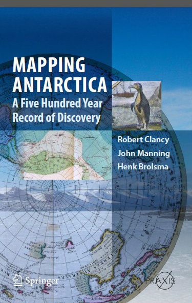
Mapping Antarctica - A Five Hundred Year Record of Discovery
by Robert Clancy, John Manning and Henk Brolsma
Springer | December 2013 | ISBN-10: 9400743203 | PDF | 300 pages | 154 mb
Everyone likes maps and maps are always used to illustrate the many books on the Antarctic. Here the focus is reversed with contemporary maps telling the story ?Çô one that should be attractive to the widest audience as it is a unique approach complimenting what has gone before and providing something different for all interested in Antarctica.
About the Authors
Robert Clancy is a Member of Order of Australia (for Immunology as well as Historic Cartology). He has made about 6 trips to Antarctica, as both a research scientist and as a tour guide (to both the Antarctic Peninsula and Australian bases). He has been collecting maps of Antarctica since 1972.
John Manning has had a long career from 1956 to 2004 in surveying, mapping and geodesy in Antarctica and remote areas of Australia. He has been closely involved in modern Australian mapping of the Antarctic since 1966..
Henk Brolsma has had a professional career in surveying and mapping for more than 30 years in different parts of the world. Since 1994 , he has held the position of Mapping officer at the Australian Antarctic Division. In that role he has been in charge of the production of more than a hundred scale maps of the Australian Antarctic territory in East Antarctica.
CONTENTS
Preface. . .. . . . . . . xiii
List of unnumbered figures, and table . . .. . . xvii
List of abbreviations and acronyms . . . . . . . . xix
Map of Antarctica. . . . . . . . . . xxii
1 Arctic and Antarctic regions are not poles apart . . . . . .. . . . 1
2 Drivers of discovery . . . .. . . . . 31
3 Antarctica?Çöthe concept: From Ptolemy to Cook . . . . . . . . . . 61
4 Antarctica?Çöthe reality: From Cook to the International Geographical Congress . . . . . 89
5 Antarctica?Çöthe heroic age: Heroes, legends, and land . . . . . . . . . . . . 129
6 Antarctica?Çöwings over the continent: From Wilkins to war. . . . . . . . . 173
7 Antarctica 1940?Çô1960: A second world war and a new order of business 195
8 Consolidation of political interest and national mapping programs (1950?Çô2010) . . . . . . . . 221
9 Antarctic science comes of age: window on the world (1960?Çô2010) . . . . 251
10 Atlas maps. . . . . . . . . . . . . . . . . . . . . . . . . . . . . . . . . . . . . . . . 271
Index . . . . . . . . . . . . . . . . . . . . . . . . . . . . . . . . . . . . . . . . . . . . . . 303
Link :
Code:http://uploaded.net/file/eakdkdkg/Mapping%20Antarctica.rar
Please visit our sponsors
Results 1 to 1 of 1
-
11-02-2014, 10:07 PM #1Senior Investor

- Join Date
- Jan 2012
- Posts
- 7,166
- Feedback Score
- 0
- Thanks
- 0
- Thanked 6 Times in 6 Posts
 A Five Hundred Year Record of Discovery
-
Sponsored Links
-
Sponsored Links


Thread Information
Users Browsing this Thread
There are currently 1 users browsing this thread. (0 members and 1 guests)
 Posting Permissions
24 Hour Gold
Advertising
- Over 20.000 UNIQUE Daily!
- Get Maximum Exposure For Your Site!
- Get QUALITY Converting Traffic!
- Advertise Here Today!
Out Of Billions Of Website's Online.
Members Are Online From.
- Get Maximum Exposure For Your Site!
- Get QUALITY Converting Traffic!
- Advertise Here Today!
Out Of Billions Of Website's Online.
Members Are Online From.